Summary
Web-based visualization for satellite close approaches
Services
PHP Scripting
KML File Creation
Google Earth API
Skills
ProgrammingSoftware Architecture
Website
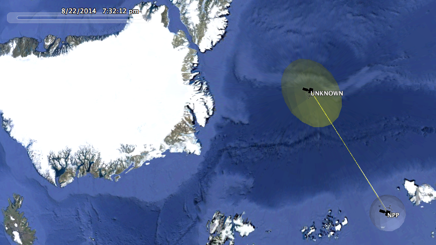 This is a web-based Google Earth visualization I designed for satellite close approaches. The system is comprised of a PHP script that ingests two satellite ephemeris files and generates a KML file. Each time step is a new GXTrack entry, so as the KML file loads the two satellites animate along their orbit path. Uncertainty is represented by 3D sphere objects that are dynamically sized. The KML file can be downloaded for offline viewing in Google Earth.